Cartographies of Connection: Recovering the Vanished Road Networks That Once Bound America's Farm Country Together
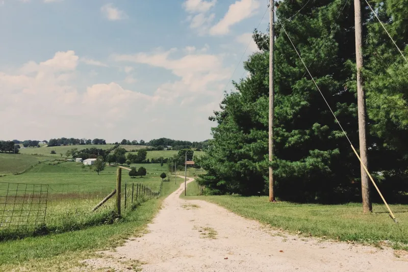
There is a particular kind of melancholy in studying an old county atlas. The roads drawn there—thin, confident lines threading between farm names and crossroads settlements—suggest a world that was, by its own internal logic, entirely coherent. Grain moved to mills. Cattle moved to railheads. Families moved to church, to market, to one another. Then, over the course of a century, much of that infrastructure quietly ceased to exist. The roads narrowed, the bridges rotted, the rail spurs were pulled for scrap, and the lanes reverted to field or forest. What remains is a landscape that looks continuous but is, in fact, full of invisible absences.
For a growing community of historians, land surveyors, and heritage researchers, recovering those absences has become a serious scholarly mission—one that is reshaping how we understand the daily mechanics of rural American life.
Reading the Land Before the Map
The earliest farm roads in America were not engineered. They were negotiated. Native American trade paths were among the first to be adopted by European settlers, who recognized that centuries of foot travel had already identified the most practical routes across ridgelines, river crossings, and seasonal wetlands. From these foundations, colonial-era post roads extended outward, formalized by provincial governments that needed reliable communication between administrative centers and the farming hinterlands that fed them.
By the mid-nineteenth century, the road network in most of the eastern and midwestern United States had become extraordinarily dense. Township maps from counties in Ohio, Pennsylvania, and Virginia reveal a capillary system of named lanes, private roads, and public thoroughfares that connected virtually every farmstead to at least two or three commercial nodes. A farmer in rural Lancaster County, Pennsylvania, might have had direct road access to a gristmill, a general store, a tannery, and a railroad depot—each served by a distinct route, each with its own seasonal character and its own social meaning.
That density is precisely what makes its subsequent disappearance so disorienting.
The Archival Work of Recovery
Historians engaged in what some have begun calling "road archaeology" rely on a layered toolkit. County deed records often contain the most granular evidence, since property transfers frequently referenced road boundaries and rights-of-way that no longer appear on modern surveys. Probate inventories sometimes noted the value of road access to a farm's overall worth—an implicit acknowledgment that connectivity was a form of capital.
Sanborn fire insurance maps, originally produced for urban commercial districts, occasionally extended into rural market towns and captured the road geometry surrounding them. General Land Office survey notes, available through the Bureau of Land Management's General Land Office Records portal, preserve written descriptions of road conditions and crossings made by federal surveyors during the original township surveys of the nineteenth century. These documents, read carefully, can locate a vanished road to within a few hundred feet.
Oral history projects have proven equally valuable. In Appalachian communities particularly, elderly residents often retain precise knowledge of routes their grandparents described—knowledge that has never been transcribed into any official record. The Southern Oral History Program at the University of North Carolina has captured a number of such accounts, and local historical societies across the rural Midwest have undertaken similar efforts with varying degrees of institutional support.
Cattle Drives, Rail Spurs, and the Architecture of Movement
Not all vanished routes were roads in the conventional sense. Cattle drives—the long, slow movement of livestock from farm to regional market or railhead—left their own imprints on the landscape. In the Shenandoah Valley, the Great Wagon Road served not only as a migration corridor for settlers moving south and west but as a commercial artery along which livestock, grain, and finished goods moved in both directions for nearly two centuries. Sections of that route are traceable today through a combination of historical marker research, deed analysis, and simple observation of road geometry in aerial photography.
Rail spurs present a different but related challenge. The branch lines that once extended from trunk railroads into agricultural districts—carrying grain cars, livestock, and farm supplies—were among the first casualties of mid-twentieth-century rail consolidation. Many were abandoned between 1940 and 1970. Their grades, however, frequently survive as subtle topographic features: slight embankments running through fields, drainage patterns that follow unnaturally straight lines, the occasional surviving bridge abutment standing in a creek bed with no bridge above it.
In states such as Iowa, Kansas, and Illinois, volunteer researchers have mapped hundreds of miles of abandoned rail corridors using LiDAR elevation data now publicly available through state geological survey programs. The results are striking. Communities that appear isolated on a modern road map were, a century ago, nodes in a sophisticated freight network that connected them to Chicago, Kansas City, or St. Louis within a matter of days.
What the Roads Reveal About Community
The recovery of these networks is not merely an exercise in historical cartography. It has substantive implications for how we interpret the social and economic life of historic farming communities.
For decades, the dominant narrative of rural America emphasized isolation—the lone farmstead, the self-sufficient family, the heroic individualism of agricultural life. The road evidence complicates that picture considerably. A farm with good road access to multiple markets was not an isolated unit; it was a participant in a regional economy that required constant negotiation, communication, and cooperation. Farmers who shared a lane to a common mill had practical reasons to maintain civil relationships. Communities organized around a crossroads store or a church at a road junction developed social institutions that depended on the road's continued function.
When a road closed—whether through abandonment, private enclosure, or the construction of a new highway that bypassed the old route—the social consequences could be severe. Oral histories from communities in rural Tennessee and Kentucky describe the gradual dissolution of neighborhood networks following the rerouting of county roads in the 1930s and 1940s. Farms that had been central became peripheral. Churches lost their congregations. Stores lost their trade. The road, it turns out, had been doing far more than moving goods.
Preservation and the Living Landscape
Some of these vanished routes are now candidates for preservation in their own right. Rails-to-Trails Conservancy has converted more than 25,000 miles of abandoned rail corridors into recreational paths, and while their primary mission is recreational, the historical documentation they produce in the process has genuine scholarly value. Several state heritage programs have begun treating historic road corridors as cultural landscapes eligible for listing on the National Register of Historic Places—a recognition that a road's history is as significant as the buildings that once lined it.
For heritage tourism, the implications are equally promising. A farm property whose historic road connections can be documented and interpreted becomes more than a collection of old buildings. It becomes a legible node in a larger story—a point on a map that once meant something to the people who traveled it. That meaning, recovered through patient archival work and attentive fieldwork, is precisely the kind of depth that distinguishes genuine heritage experience from mere nostalgia.
The ghost roads of rural America are not entirely gone. They persist in deed books, in survey notes, in the memories of aging neighbors, and in the faint geometry of fields that were once organized around them. Finding them again is, in its own way, an act of reconnection—a restoration of the ties that once held farm country together.